


Drones Track Spread Of Infectious Disease Through Ecological Pattern Recognition
Civilian purposes for unmanned aerial vehicles (UAVs), frequently called drones, include firefighting, parcel delivery, and farming, where they enable the monitoring of vegetation, crop growth, and weed distribution. Compared to agriculture, the application of drones in ecological research has not been explored as fully. In an opinion piece published in Trends in Parasitology, a group of scientists demonstrate how they are employing drones to understand the environmental factors influencing the spread of infectious diseases.
Because they possess the ability to collect detailed information at relatively low cost, drones have been used for monitoring environmental situations too dangerous for traditional aerial surveillance, including mapping ice floes in the Arctic or conducting anti-poaching patrols in Africa. However, what about other areas of science — how might the use of drones enhance infectious disease epidemiology? Dr. Kimberly Fornace, London School of Hygiene and Tropical Medicine, and her colleagues say their new study of a strain of malaria that is carried by monkeys and can infect humans proves the utility of drones in helping researchers understand ecological patterns underlying the spread of pathogens.
Land-Use Changes, Including Suburbanization and Disease
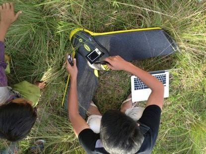
Specifically, Fornace and her co-researchers are using drones to collect data and map changes in mosquito and monkey habitats. Following surveillance, the team compares the gathered UAV data with hospital case records to understand the ways in which evolving habitats affect human infection and disease risk. Among the many benefits of drones is their ability to detect patterns, to obtain data in real-time, and to map areas of interest as frequently as required. At a site in Malaysia, under observation by Fornace and her crew, a forest was being cleared to establish a rubber plantation; using UAVs, the researchers could update the progress of deforestation quickly and routinely. In fact, real-time surveys of forests and habitation areas are crucial for understanding disease-carrying organisms.
“Land-use change, for example, through deforestation or agricultural expansion, has been widely documented as a major driver of infectious disease emergence and spread,” wrote the authors in their article. Lyme disease follows this pattern. Research suggests suburbanization, specifically turning exurbs into suburbs, results in an increased number of small animals, while also bringing infected tics into greater contact with humans.
Along with real-time surveys, drones offer other benefits. Compared to satellites, UAVs sidestep cloud contamination and low spatial resolution, yet they similarly can produce “stereo” images used for 3D visualizations and generation of digital elevation models. However, UAVs also have limitations unkown to satellites; they cannot fly in all weather conditions, and high temperatures may cause them to overheat. Finally, drones are not yet capable of gathering data provided by remote-sensing methods such as radar.
While scientists explore the benefits of UAVs, others lie awake at night worrying about their expanding use and what this means for nations.
Surveillance Society
A September report from the Government Accountability Office found “over 80 percent” of Customs and Border Patrol (CBP) drone flight hours linked to airspace above border and coastal areas within the U.S. This suggests about one fifth of all CBP drone time may be invested in other authorized activities, including “support for federal, state, and local law enforcement operations.” According to the American Civil Liberties Union, “U.S. law enforcement is greatly expanding its use of domestic drones for surveillance,” and shortly, drone manufacturers may offer police the option of “arming remote-controlled aircraft with (nonlethal for now) weapons like rubber bullets, Tasers, and tear gas.”
Earlier this year, The Washington Post reported on the increasing use of drones, domestic and otherwise, and highlighted the frequency of crashes: since 2001, more than 400 large U.S. military drones have crashed in major accidents worldwide. Shockingly, a 375-pound Army drone crashed next to an elementary-school playground in Pennsylvania in April, minutes after students left for the day, while an Air Force UAV plunged into Lake Ontario in November. In 2012, a Navy surveillance drone “with a wingspan as wide as a Boeing 757′s” literally crashed and burned, igniting a wildfire on Maryland’s Eastern Shore. As framed by the Post, the next phase of drone use will focus on surveillance beyond “traditional, declared combat zones.”
Meanwhile the Federal Aviation Administration predicts that as many as 7,500 small commercial drones could take flight across much of the country by 2018. What will this mean in terms of personal privacy?
In the United Kingdom, a University of Birmingham Policy Commission Report raised the now familiar specter of unmanned aircraft being used by terror groups. Just as in the U.S., predicted use of drones in the UK should increase considerably over the next 20 years, bringing "significant benefits," economic and otherwise. However, the report also recognizes “acquisition of [remotely piloted aircraft] by potential adversaries — state and non-state” could prove dangerous in terms of “threat or actual use.”
Source: Fornace KM, Drakeley CJ, William T, Fe E, Cox J. Mapping infectious disease landscapes: unmanned aerial vehicles and epidemiology. Trends in Parasitology. 2014.
Published by Medicaldaily.com


